Ride Story · Southwest Virginia
Riding the Back of the Dragon
Big Walker Lookout, a mountaintop Civil War story, and 438 curves on Route 16
32
miles
438
curves
3
mountains
Labor Day
weekend 2019
Every rider has heard about the Tail of the Dragon down in Tennessee. What a lot of folks don’t know is that Virginia has its own dragon, and it’s a lot closer to home. On Labor Day weekend in 2019 we pointed the Spyders toward Southwest Virginia to finally ride the Back of the Dragon, Route 16 between Tazewell and Marion.
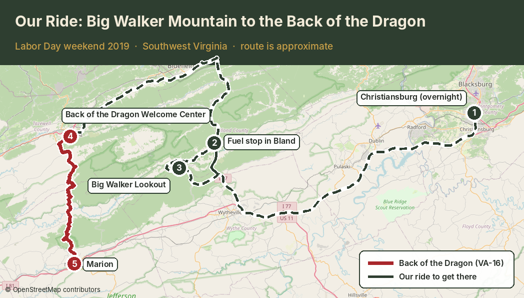
We spent the night in Christiansburg, fueled up in Bland the next morning, and made our first real stop on top of Big Walker Mountain before heading over to Tazewell to meet the dragon.
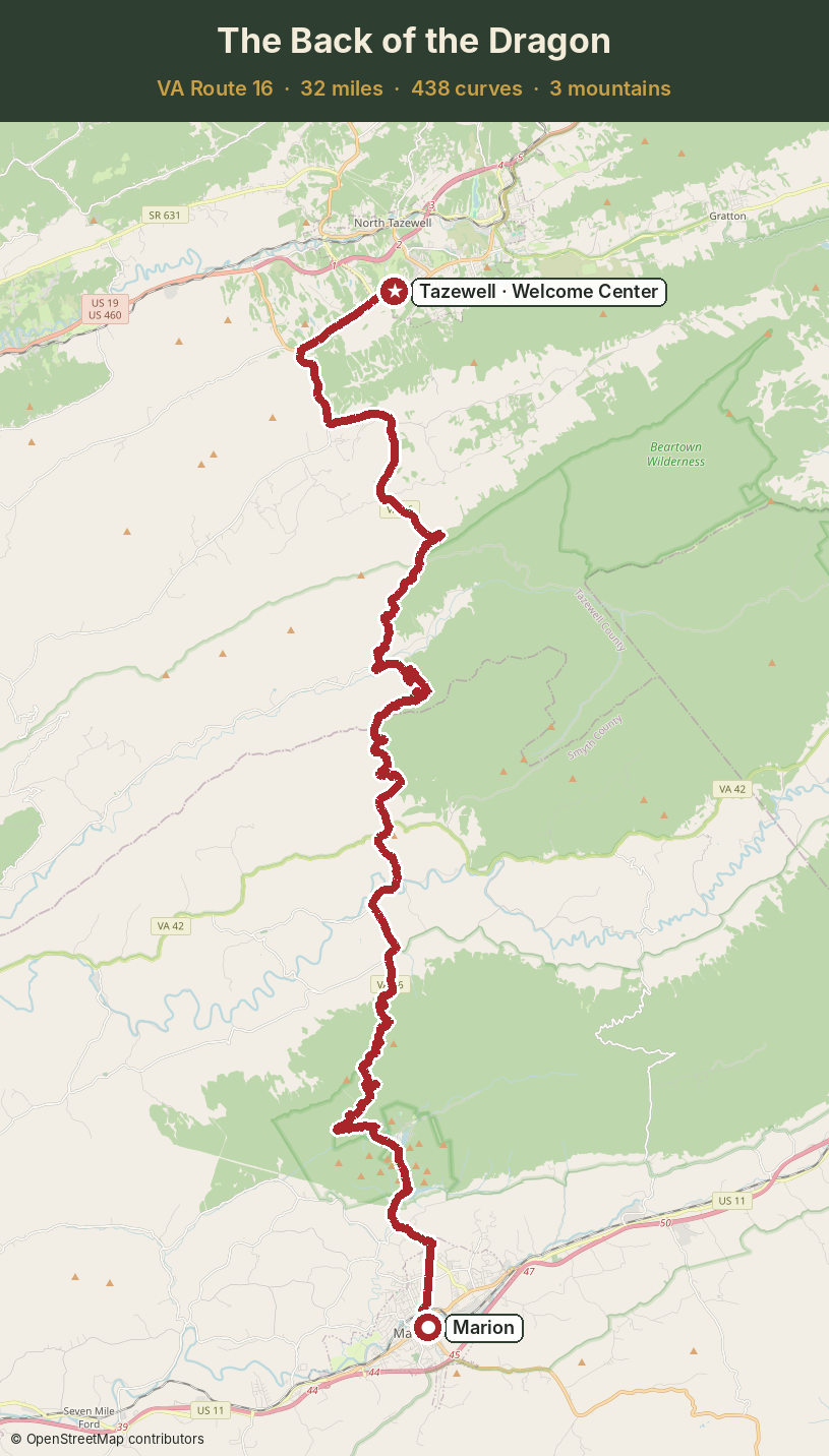
Our route
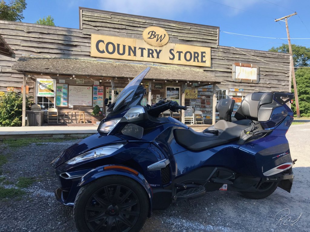
Morning on Big Walker Mountain
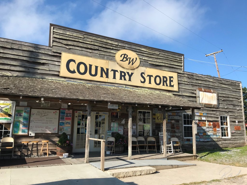
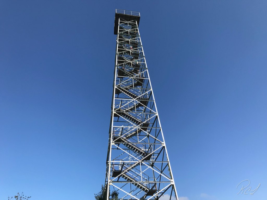
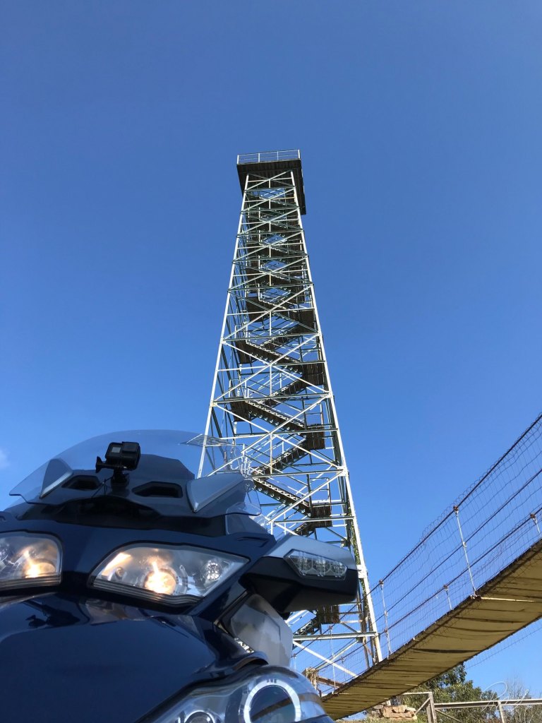
Big Walker Lookout sits right on US 52, about 12 miles north of Wytheville. The road up the mountain is a nice warm-up for what was coming later. Up top you’ll find the BW Country Store, a swinging bridge and a 100-foot steel lookout tower. The tower has been there since 1947, and the same family, the Kimes, has run it the whole time. The mountain is named after Dr. Thomas Walker, an early explorer of this part of Virginia.
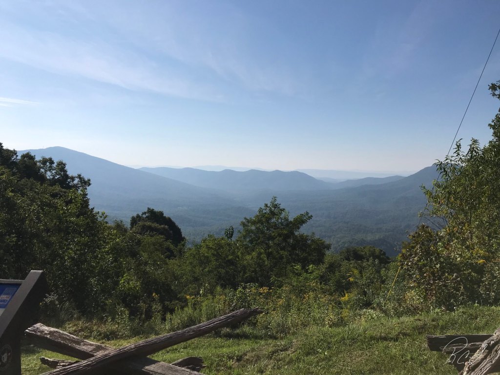
The mountaintop sits at about 3,405 feet, and from the top of the tower you can see peaks in five states on a clear day. Even from the overlook by the parking area, the view goes on and on: ridge after blue ridge rolling off toward the valley.
A Civil War story on the mountaintop
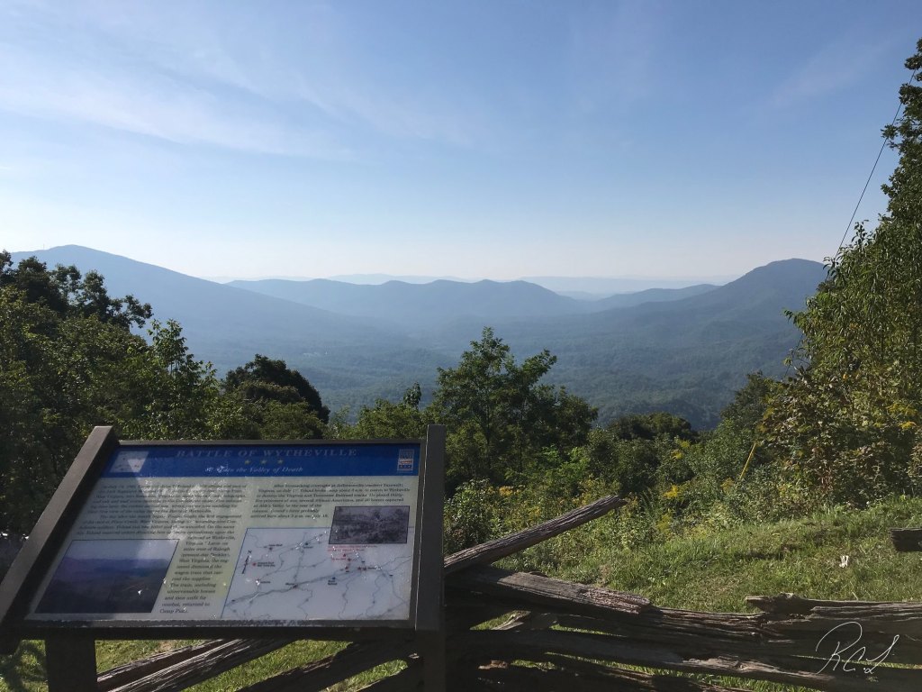
Right by the overlook is a Virginia Civil War Trails marker for the Battle of Wytheville. In July 1863, Union Col. John Toland led a mounted raiding party of about 800 men from Tazewell County, over this very mountain, to tear up the Virginia and Tennessee Railroad at Wytheville. A young woman from the area, Molly Tynes, rode ahead to warn the town. When the raiders got to Wytheville on the evening of July 18, local defenders were waiting. Toland was killed in the fighting, and the railroad was saved. This overlook is where his men got their first look at the valley below.
Meeting the Dragon in Tazewell
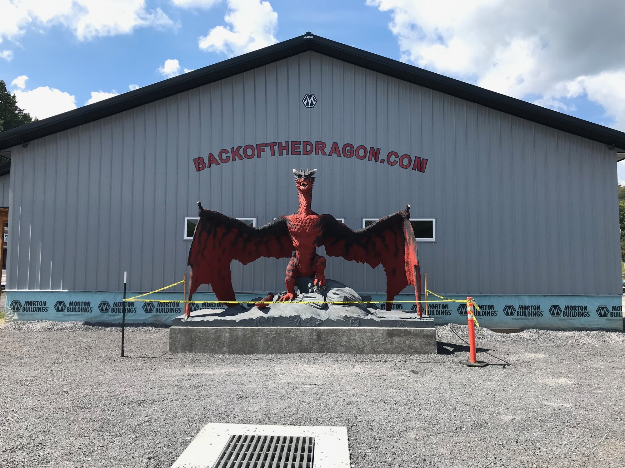
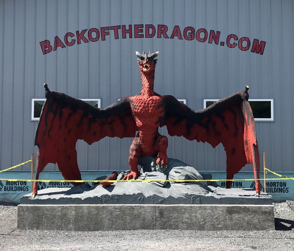
By lunchtime we rolled into Tazewell and the Back of the Dragon Welcome Center on Main Street. The center opened in 2019, and when we were there that Labor Day weekend it was so new the caution tape was still up around the dragon. That dragon is about 12 feet of red and black scales and spread wings, and it’s the photo every rider stops for. Today the building has rider gear and souvenirs, coffee, local craft beer, and maps and tips for the road ahead.
A little history of the Back of the Dragon
Route 16 has been winding over these mountains for a long time, but it didn’t have a name riders knew. That changed thanks to Larry Davidson, a Tazewell native and avid rider. He saw how the road climbs up and over three mountain ridges, Clinch, Brushy and Big Walker, and thought it looked like the humps on a dragon’s back. He worked with the Tazewell County tourism folks, and Route 16 was officially recognized as the Back of the Dragon.
The Dragon runs 32 miles between Tazewell and Marion, near Hungry Mother State Park. Those 32 miles pack in 438 curves, tight switchbacks and big climbs, plus long mountain views when you get a safe spot to pull off. It’s become a bucket-list road for motorcycles, Spyders and sports cars alike.
Riding it on three wheels is a blast, but it keeps you honest. The curves come one right after another, and you’re always working the bars. Take your time, ride your own ride, and enjoy every one of those 438 turns.
If you go
- Back of the Dragon Welcome Center: 592 W. Main St., Tazewell, VA. Stop here first for maps and the dragon photo.
- Which way to ride: Starting in Tazewell is easiest for a first run. Riding north from Marion (I-81, Exit 45) ends your ride at the Welcome Center. It feels like a different road each way, so try both if you can.
- Big Walker Lookout: 8711 Stony Fork Rd., Wytheville, VA, on US 52 about 12 miles from I-81, Exit 70. It’s free to stop and enjoy the view; there’s a small fee to climb the tower.
- Weather: It can be cooler and rainier up on the ridges than down in town, especially in spring and fall. Pack a layer.
- Road tips: Watch for gravel, leaves and branches in the corners, especially after rain. Only stop where there’s a safe pull-off.
- Fuel: Fill up in Tazewell or Marion. There’s not much in between.
Handy gear for a curvy mountain ride
- Bluetooth helmet communicator: so you can call out the next curve or lunch stop to each other.
- Waterproof handlebar phone mount: keeps the map in view when cell service comes and goes.
- Packable motorcycle rain suit: mountain weather changes fast up on the ridges.
- Digital tire pressure gauge: check before you head up the mountain. The right pressure matters on 438 curves.
Have you ridden the Back of the Dragon? Tell us which direction you liked best in the comments.
#BackOfTheDragon #CanAmSpyder #SpyderLife #SouthwestVirginia #Route16 #BigWalkerLookout #MotorcycleRoads #VirginiaIsForLovers #ScenicDrives #RoadTrip #TwoRoamWild
As an Amazon Associate we earn from qualifying purchases.


Leave a Reply